stanford graduate
my work
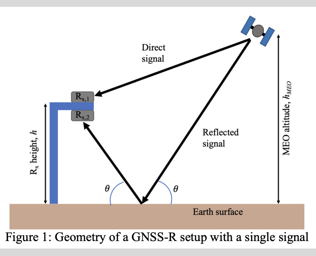
I simulated a GNSS-R setup assuming the configuration shown in this diagram.

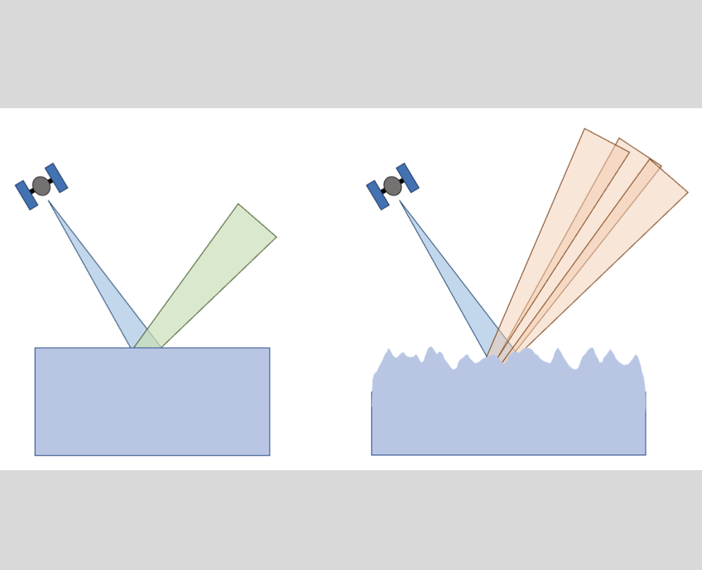
Signal uncertainty increases when considering incoherent scattering compared to ideally coherent scattering. This diagram visualizes the increase in uncertainty.

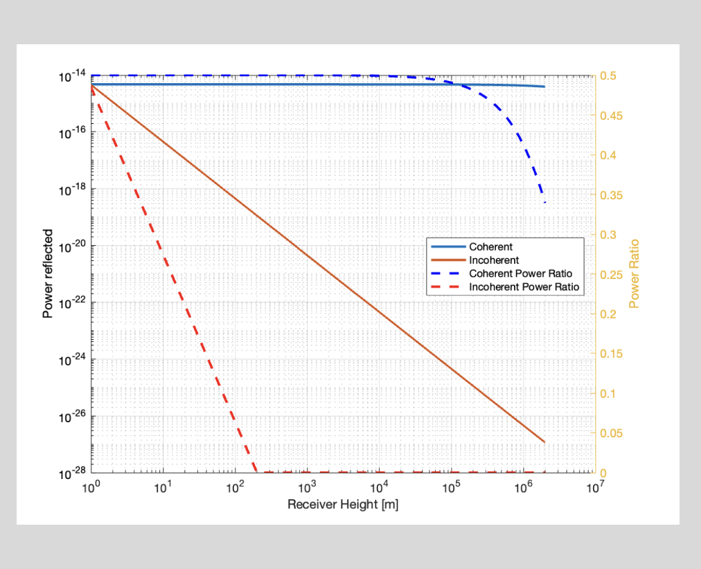
Simulation results outline the expected power received using coherent vs. incoherent assumptions. As the height of the reference receiver, received power decreases significantly.

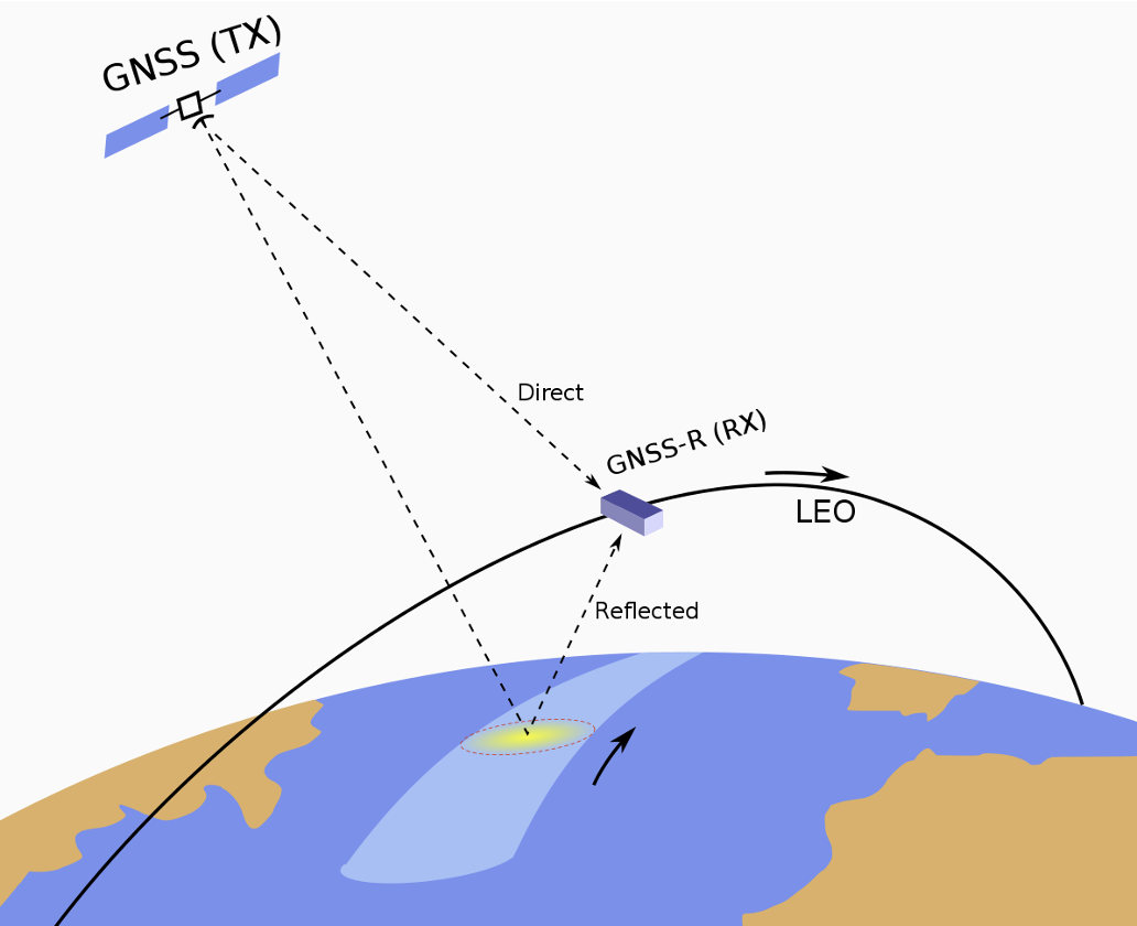
This is a depiction of a similar LEO GNSS-R configuration found online. Image credit from https://en.wikipedia.org/wiki/ GNSS_reflectometry.


